
Valle de las Animas
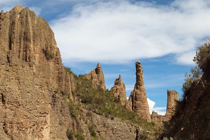
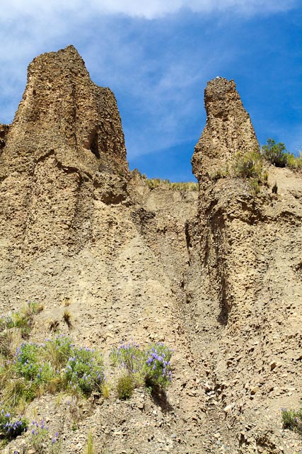 The Valle de las Animas, or Valley of Souls, is seriously misnamed. It is not a “valley” but a region, and I for one fail to see why there is any reason to believe that the rock formations therein have any resemblance to “souls.” After all, isn’t their lack of a physical form a key part of the definition of “soul?” That said, the Valley is very close to La Paz, and the unique rock formations give you a fun hike within minutes of home. Actually, it is probably quite a few fun hikes, given the large area.
Aliciya, explorer
If you want to know what the rock formations are like in the Valle de las Animas, just look around yourself in the Zona Sur of La Paz. All those spires and dirt/stone walls standing around the Zona Sur are quite similar to the “animas.” If you have ever wanted to wander off among them, the Valle de las Animas is the place to do that.
I’ve just scratched the surface of possible hikes in the Valle de las Animas, but I figured I’d go ahead and provide what little information I do have on the area. Maybe I’ll have the chance to add more later. At the same time, the route I use to get to the Valle (described below) is also the jumping off point for travels in the whole Palca area, something I definitely will explore in future posts.
 From the South
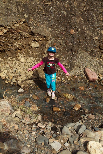
It’s quite easy and fast to get to the Valle. To enter from the south, head out of town on the road to Palca. To do that, you head east on Avenida Ballivian, passing through the area known as Chasquipampa and climb up out of the city. Measuring from the intersection of Ballivian with Calle 25 (Arturo Fortun Sanjines), some 5.5 miles, the road passes over the ridge into the next valley at some 13,015 feet of altitude and you see a pond to the right of the road. From there it is only a half-mile down into the valley before you cross the bridge which signifies your stopping point. You can park on the old road which forded the river before the new bridge was built, but the road is washed out just a few yards up from the bridge, so you will be walking from here on out.
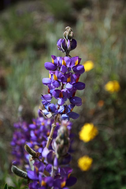
This time of year, with the increase in rain, there are lots of wildflowers about.
We walked a short seven tenths of a mile up the narrow canyon directly above the bridge, at which point the “animas” were becoming less common and less interesting. Looking on Google Earth, I suspect that the scenery in the next canyon west would be more rugged and beautiful, so that is the way I would go next time. Again, looking at Google Earth and at the topographical maps, it appears that there are other routes into the area which might be more interesting. In particular, it appears that one could drive up into the canyon on the Rio Ovejuyo from Chasquipampa, which might be an interesting prospect. If you had a whole day, you could hike from one side to the other, taking in much of the area. One web site I saw suggested that hike might take 5-6 hours.

The area between the road, marked in blue, and the Rio Ovejuyo (light blue) is all “animas” country.
As usual, I have included a .gdb file, showing the exact route I took. The relevant topo map is La Paz (Sur) 5944-II.
Posted: March 6th, 2013 under Bolivia, Day Trip, Flowers, Google Earth, GPS, Hiking, La Paz, Mapping, South America, Uncategorized.
Tags: Aliciya, Bolivia, Day Trip, Flowers, Google Earth, GPS, Hiking, La Paz, Mapping, Mountains
Comments
Write a comment
You need to login to post comments!
Pingback from Larry Memmott's Blog » Condors!
Time March 17, 2013 at 9:21 pm
[…] get to Laguna Arkhata, take the road to Palca out of the city, as described in the post on hiking in the Valle de las Animas. Rather than turning south towards Palca, continue on this road towards the Yungas. At 5.5 […]