Rosapata and Lirqu
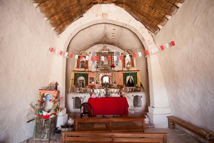
Interior of the Rosapata Chapel
Rosapata and Lerqu make a great side trip on your way to Curahuara de Carangas. The two chapels are small and humble, but each is beautiful in its own way. Also, the landscape is spectacular. That said, this is not a trip to take in your nice sedan, and it is going to take you two hours plus. Also, the road is often impassible in the rainy season. Still, with a good 4×4 and a dry road, this is definitely a worthwhile trip.

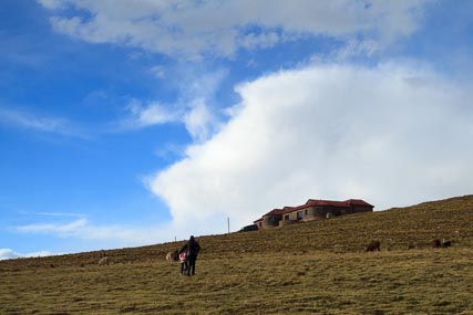
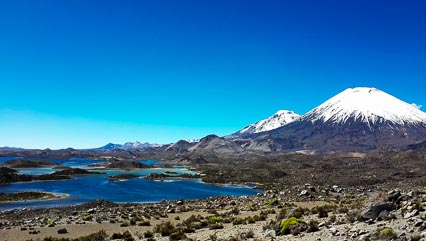
Scenery on the way to Rosapata
To reach the Rosapata and Lerqu loop road, turn right onto the unmarked dirt track some 8.5 miles from the Huchusuma turnoff. Almost a mile from the turn you will ford a small river. This is probably impassible after rain, as is much of the road, but in dry season does not present a problem. After climbing out of the stream, you reach a fork in the road. The right fork takes you to Rosapata, while the left goes to Lerqu. Either will serve you fine, as you will loop around and return to this fork after seeing both churches. That said, I will describe the trip to Rosapata, first and then on around to Lerqu and back.

Map to Rosapata & Lerqu (click to expand)
The right fork follows the river for a short ways and then turns off to the left along the side of large bofedales (high-altitude wetlands) which are used by the locals to pasture their llamas and alpacas. After passing the small village of Pacotani and then veering again to the left, you come again, after another six miles, to a fork in the road. Again, take the right to reach Rosapata. You’ll return to this fork and take the left to reach Lerqu after visiting Rosapata. You climb up on the right side of a small gorge and then turn right around another bofedal. The scenery is beautiful all along the trip. Some two miles further you will find a pair of gates across the road. They are not locked and you can pass through them easily, but please remember to always leave gates in cattle country as you found them – either open or closed. The fences here keep the llama herds of different herders apart, something which can be very important for the locals.

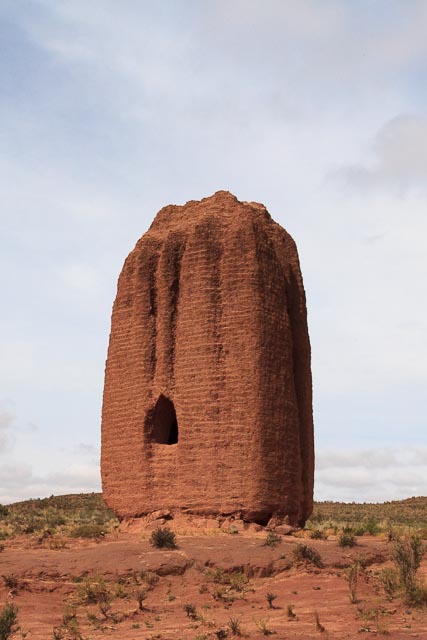
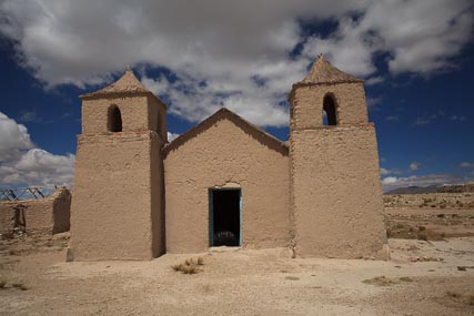
Rosapata Chapel
Just another mile, and you will be seeing the Rosapata Chapel on the side of the hill above the road. There are a few houses near the chapel, but mostly it serves a community spread out over the surrounding altiplano. Walter Condori has the key, and his mom lives in the house at the bottom of the hill, closest to the chapel, but he is most often found in Curahuara de Carangas, so if you want to get inside, you probably need to call ahead to make arrangements. The walk up the hill to the chapel is short, only about 0.2 miles, but a bit steep, as you climb up some 150 feet of altitude. The views from the hill are nice, though. There is also a “stations of the cross” walk to the hills above. As with many of the “stations of the cross” in the region, the high points on which the crosses are erected are generally believed to have been holy sites long before the Spanish brought Catholicism to Bolivia. The Rosapata Chapel is dedicated to the Virgen de la Candelaria (Virgin of Candelaria), though the feast day is celebrated on August 2, as opposed to the usual feast days for the Virgin of February 2 and August 15.

Ruins near the chapel
To the side of the chapel are the ruins of a village, with homes made of stone. The locals dream of turning these remains into a small community albergue for tourists. Services are held by Padre Gabriel Antequera, who lives in Curahuara, every other Friday, and are followed by an optapi, or traditional Bolivian picnic, and often some common work maintaining the chapel or the area thereabout.
Repair of the Two Churches
Both of these chapels were repaired with funding from the Ambassador’s Fund for Cultural Preservation of the U.S. Government. The project was sponsored by the U.S. Embassy in La Paz and carried out in 2011. For a little more information on the project, which in total has repaired and preserved 11 colonial-era chapels on the Altiplano, see Preserving Colonial Churches.
Lerqu

Lerqu Chapel
Lirqu is spelled in many ways, trading the “qu” (pronounced “co” as in “cope”) for the more standard Spanish spellings of that sound, “ko” or “co” and more often than not, trading the “i” for an “e.” It is the location of a small village and another attractive chapel. It is closer to the road than Rosapata, but probably still not reachable in vehicle during the rainy season. Although the construction of these two chapels is similar, the placement of the bell tower next to the chapel, rather than on the perimeter wall as in Rosapata, gives it a different look altogether. Also, Lirqu sports a fully restored stone patio at the front of the church, which is quite attractive. Lirqu is dedicated to “El Señor de la Cruz,” and the relevant feast day is May 3.

Interior of the Lirqu Chapel
Getting There
From Rosapata, you backtrack three miles to the fork previously mentioned. Here you take the sharp right that puts you on the other fork. You drive up the left side of the small gorge this time, and turn toward the left (south) when you come to the top. About seven miles from the turn you pass through another gate, and after another half mile, come to another fork, and take the right, again. You will see the chapel about now, since it is just half a mile up this spur at the top of the small village.
Spectacular Scenery everywhere
Getting Back
Getting back to the main road is easier, as you have almost completed the loop at this point. Backtrack the half mile to where you turned right towards Lerqu, and instead of turning, pass by the turn and continue on, roughly northwest, for about three miles to the first of the forks in the road and the ford across the river. From there, continue almost a mile on the road you took to the ford, and you are back to the main highway.
Posted: December 15th, 2013 under Altiplano, Archeology, Bolivia, Celebration, Churches, Day Trip, GPS, Hiking, La Paz, South America, Travel.
Tags: Altiplano, Bolivia, Churches, Day Trip, GPS, Hiking, La Paz, Mapping, Travel
Comments: 1