Site menu:

How Fun!

On Sunday, for the first time, the press took note of this blog.  Pagina Siete, one of Bolivia’s most important newspapers said, “. . . the leader of “a” embassy, Larry Memmott, has a very professional blog (www.memmott.us) about tourism in Bolivia, in which he promotes the places he visits.”

Very nice of them.  Thanks!


Pagina Siete, March 3, 2013

Pagina Siete, March 3, 2013

Valle de las Animas


_MG_2039The Valle de las Animas, or Valley of Souls, is seriously misnamed.  It is not a “valley” but a region, and I for one fail to see why there is any reason to believe that the rock formations therein have any resemblance to “souls.”  After all, isn’t their lack of a physical form a key part of the definition of “soul?”  That said, the Valley is very close to La Paz, and the unique rock formations give you a fun hike within minutes of home.  Actually, it is probably quite a few fun hikes, given the large area.

Aliciya, explorer

Aliciya, explorer

If you want to know what the rock formations are like in the Valle de las Animas, just look around yourself in the Zona Sur of La Paz. All those spires and dirt/stone walls standing around the Zona Sur are quite similar to the “animas.” If you have ever wanted to wander off among them, the Valle de las Animas is the place to do that.

I’ve just scratched the surface of possible hikes in the Valle de las Animas, but I figured I’d go ahead and provide what little information I do have on the area.  Maybe I’ll have the chance to add more later.  At the same time, the route I use to get to the Valle (described below) is also the jumping off point for travels in the whole Palca area, something I definitely will explore in future posts.

_MG_2068From the South

It’s quite easy and fast to get to the Valle.  To enter from the south, head out of town on the road to Palca.  To do that, you head east on Avenida Ballivian, passing through the area known as Chasquipampa and climb up out of the city.  Measuring from the intersection of Ballivian with Calle 25 (Arturo Fortun Sanjines), some 5.5 miles, the road passes over the ridge into the next valley at some 13,015 feet of altitude and you see a pond to the right of the road.  From there it is only a half-mile down into the valley before you cross the bridge which signifies your stopping point.  You can park on the old road which forded the river before the new bridge was built, but the road is washed out just a few yards up from the bridge, so you will be walking from here on out.

This time of year, with the increase in rain, there are lots of wildflowers about.

This time of year, with the increase in rain, there are lots of wildflowers about.

We walked a short seven tenths of a mile up the narrow canyon directly above the bridge, at which point the “animas” were becoming less common and less interesting.  Looking on Google Earth, I suspect that the scenery in the next canyon west would be more rugged and beautiful, so that is the way I would go next time.  Again, looking at Google Earth and at the topographical maps, it appears that there are other routes into the area which might be more interesting.  In particular, it appears that one could drive up into the canyon on the Rio Ovejuyo from Chasquipampa, which might be an interesting prospect.  If you had a whole day, you could hike from one side to the other, taking in much of the area.  One web site I saw suggested that hike might take 5-6 hours.

The area between the road, marked in blue, and the Rio Ovejuyo (light blue) is all "animas" country.

The area between the road, marked in blue, and the Rio Ovejuyo (light blue) is all “animas” country.

As usual, I have included a .gdb file, showing the exact route I took.  The relevant topo map is La Paz (Sur) 5944-II.

Death Metal in El Alto

The festival was unfortunately named.  I accept no responsibility.

The festival was unfortunately named. I accept no responsibility.

I’ve occasionally put up posts on music in the past, but it looks like I may be putting up more such posts in the future.  I went with some friends to a Death Metal Festival the other day (posters above and bottom).  It was fantastic.  The variety of music (within the Metal genre) was stunning, and the musicianship was, frankly, a huge surprise.  We are definitely going to be exploring the Bolivian rock scene more deeply.

Rock Chicks on Stage:  Tatyana, Karin and Leonore on stage with Mariagrizel, the drummer from Obitus Designious

Rock Chicks on Stage: Tatyana, Karin and Leonore with Mariagrizel, the drummer from Obitus Designious

We were there for eight hours and saw about half of the lineup.  Unfortunately, that was about all we could handle.  Maybe we will have to build up to it slowly.  I’ll run through a short review of the event and of the bands we saw.  In sum, though, this is a must-do activity for anyone in Bolivia interested in rock.

Obitus Designious with our crew

Obitus Designious with our crew

The venue was one of the many event halls in El Alto.  It wasn’t big, but managed to handle the crowd reasonably.  As they evening went on, though, it did get very smoky and there was no fresh air.  Happily, there was a courtyard outside the hall, but off the street, where you could gulp in some fresh oxygen between acts.

. . . and with the girls

. . . and with the girls

Like always in Bolivia, the crowd was friendly and welcoming.  Most were young, and most seemed to be from El Alto.  The gender mix was a bit surprising – there were many more women than one would find at a similar event in the U.S.  I didn’t count the number of people who came up to me (very visibly an outsider) and welcomed me, several even thanking me for visiting Bolivia or for coming to the show.  Of course, all were curious about where we were from.  As the evening progressed, the alcohol consumption kept up with the music, and the dancing became more raucous, as is usual.  A fight (apparently over a girl) did break out in the courtyard, at one point, but it was quickly over without too much damage being done.  All in all, though, I would say the “moshing” and the pushing and shoving was less violent, and more respectful of non-moshers, than at many concerts I have attended in the U.S. and elsewhere.

The Bands

The quality and diversity of the bands was the huge surprise of the afternoon.  One Cruzeño I had the opportunity to talk to between acts said that even related musical genres do not mix in Bolivia.  He said that Death Metal and Black Metal do mix, but Thrash Metal and Punk have their own scenes and never come together with each other or the first two.  The festival was focused on Death Metal and Black Metal, but the variety of music within those genres was quite a shock.  To give you a taste, I’ll run through the bands we saw, describe their music, and upload a representative sample (not whole songs, mostly just random outtakes).

ODObitus Designious

Obitus is a quartet, with Rodrigo Acosta Vargas fronting and playing the base guitar, Luis Bejarano on the Guitar and Mariagrizel Chavez tearing into the drums – the forth member, apparently a recent addition, is not named on their Facebook page.  They came together in September, 2012 and hope to have an album out by mid-2013.  They list Sepultura, Slayer, Anthrax, Deicide, AC/DC, Iron Maiden, Kreator, Destruction, Sodom, Pink Floyd, Queen, and Black Sabbath as influences, but clearly are more heavily influenced by the more metallic members of the list.

[flv]http://memmott.us/blog/wp-content/uploads/2013/03/DSCN2805.flv[/flv]

By the way, please pardon the slowness, but if you expand to full screen, you will get a pretty good look.

Saita

This is an all-girl trio and they are incredible!  I don’t have the names of the participants, and they don’t have a facebook page (yet), but I’ll certainly be watching for an opportunity to see them again.  This is simple, hardcore death metal.  The girl who fronts the band has a deep, dark, loud, powerful death growl into which she puts not only her voice but her entire body.  The guitarist and drummer are both good, as well, but they do tend to fade into the background when the lead singer is doubled over, as if in pain, pushing out that growl.  Wow!

[flv]http://memmott.us/blog/wp-content/uploads/2013/03/DSCN2816.flv[/flv]

[flv]http://memmott.us/blog/wp-content/uploads/2013/03/DSCN2817.flv[/flv]


Belfast

Really?  Celtic metal in El Alto?  Yes!  And Belfast is fantastic.  With eight (!!) musicians up on the small stage, including a flutist and an electric violin, Belfast makes an impression.  The two lead singers, trying to weave their participation together sometimes by alternative phrases, need more practice to get a difficult idea to actually jell, but the music behind them, including the prominent flute and electric violin are a pleasure to listen to and made a wonderful break after Saita’s deep death metal.  Celtic metal, a fusion of death metal and Celtic folk music, is naturally softer and more lyrical and melodic than other sub-genres of death metal.  That said, Belfast is notably more “death” and less lyrical than, for example, Celtic metal pioneers Cruachan.

[flv]http://memmott.us/blog/wp-content/uploads/2013/03/DSCN2819.flv[/flv]


PurgPurgatorium

Purgatorium is an excellent band from El Alto, but it does have a couple of twists.  Most noticible, the musicians wear masks.  It’s not to keep people from recognizing them (everyone sees their faces as they come in and leave, anyway), but it does give the performance an extra bit of the macabre.  And while the music is mostly traditional death metal, with the usual death growls performed by the lead singer, there is a female backup singer who adds some higher pitched screams as a counterpoint.  It is pretty effective.  Purgatorium has a Facebook page, but I didn’t find any clips on YouTube.

[flv]http://memmott.us/blog/wp-content/uploads/2013/03/DSCN2821.flv[/flv]


Prodious

Prodious serves up some good melodeath metal (or melodic death metal).  The lead singer has a great voice, and uses it for a more melodic sound, with some light screaming.  You get none of the traditional death growls with Prodious.  In fact, the words are almost comprehensible at times.  Take a look at the hands of those two guitarists, especially the one on the right side of the screen.  He is shredding!  He was certainly one of the best guitar players of the night — maybe the best.  As far as I can see, the band has no internet presence.

[flv]http://memmott.us/blog/wp-content/uploads/2013/03/DSCN2825.flv[/flv]


Maldicion Kennedy

Maldicion Kennedy

Maldicion Kennedy

Another interesting band mixing a heavy metal sound with some more lyrical folk elements, this time, Bolivian folk.  With three Kennedy brothers in the band (maternal last names, anyway), they come by their seemingly semi-American name honestly.  Marco Antonio Ordoñes Kennedy plays the base guitar, and then drops it, occasionally, for the quena or zampoña, singing sometimes, as well.  Edgar Ordoñes Kennedy sings and plays the guitar.  Raul Ordoñes Kennedy is on the keyboard, while Juan Aron Mariscal Roselio takes care of the drums.  Maldicion Kennedy is from norther Potosi department.  I quite enjoyed the band, and liked the inclusion of the quena in the mix (the zampoña did not appear).  Maldicion Kennedy has a Facebook page and a number of videos up on YouTube. By the way, the first clip below, with its high-pitched singing, is not very representative of most of the Kennedy sound, which tends toward more traditional guttural vocals. The second clip gives a taste of the integration of the quena into the music.

[flv]http://memmott.us/blog/wp-content/uploads/2013/03/DSCN2826.flv[/flv]


[flv]http://memmott.us/blog/wp-content/uploads/2013/03/DSCN2829.flv[/flv]


Angaros

Angaros

Angaros

Unfortunately, we got hungry.  Had to make a run out for fried chicken.  Missed Angaros’ set.  Facebook page.  There are several video clips up on YouTube.


DarkDark

By the time we got back, the Dark set was mostly over. What little I saw suggested a more traditional death metal sound. They do have a Facebook page.


AMAve Maria

Ave Maria was a favorite of mine.  Slightly more melodic than some of the other bands, it was apparently a favorite of many others, as well — the crowd seemed to know the words to all the songs. And check out the electric charango — now that is cool.  Ave Maria has a Facebook page, but I haven’t found any online video clips.

[flv]http://memmott.us/blog/wp-content/uploads/2013/03/DSCN2830.flv[/flv]


Bands We Missed

M16M-16:  Facebook page.  One video on YouTube.


Iscario-t:  I can’t find a Facebook page, but there are a number of video clips up on YouTube.

SabSabathan:  Facebook page.  Has a number of videos up on YouTube.


TMThrashmaniacs: Facebook page.


TunTunupa:  Facebook page.


66sex

Six Six Sex:  Facebook page.


Tumba Ancestral:  No internet presence, as far as I can see.

Guillotina:  This was the name of a well-known Mexican metal band, but I don’t find any real information on the Bolivian band.

MboGMorbogore:  Facebook page.


What’s Next:

Another night of metal at the Oveja Negra, in El Alto.

Another night of metal at the Oveja Negra, in El Alto.


Obitus Designious will be playing the Perla Negra, in La Paz, on March 23.


529808_600161560010358_1119891417_n

Maps in Bolivia

Diplomats are crazy about maps, and I am no exception.  So if this post seems over the top, please chalk it up to my profession and just use what you find useful.

My own preferences in maps, though I love them all, are topo maps and my GPS.  When I’m at home, Google Earth and Google Maps do a wonderful job.  However, OziExplorer is also an incredible piece of software for working with maps, and I use the new Garmin Software, BaseCamp, which can be downloaded free of charge, to work with my GPS.  Other good software you might want to get is GPSBabel and, perhaps, Bentley View V8i, both of which are also free.  I’ll run through all these programs and give you a clue what they can help you with and why you might want to use them, after discussing the maps.

There are lots of maps available in Bolivia.  Many paper maps are given away for free.  Most of them are not worth the paper they are printed on.  That said, excellent maps are available, and some of the best can be downloaded  free-of-charge on the internet.

For Your GPS

etrex
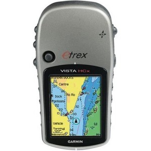
First, you will want to feed your GPS.  I won’t review what GPS you should buy for Bolivia, since the only one I have ever used is Garmin.  That said, what I can say about Garmin is that it is a standard, with which most everyone tries to be compatible.  That is a huge advantage.  I use a Garmin eTrex Vista HCx, which is a wonderful little device.  They have recently been discontinued by Garmin, so you could probably get one cheap.  That said, there are good reasons for the discontinuation, I suppose.  Some of the new models, besides their larger screens and greater capacity and accuracy, actually have facilities for you to put your own scanned topo maps onto them.  I haven’t used those facilities, but the idea certainly seems intriguing.

Anyway, to get back to what I do know something about . . .

Open Street Map: The Free Wiki World Map Open Street Map: The Free Wiki World Map

Garmin does not sell any maps of Bolivia (that I am aware of), so you have to find someone else to provide maps for use in your GPS. I have been using an implementation of Open Street Map (OSM). It’s a very cool wiki-map thing. Basically, anyone can register and then edit the map. I have added a fair amount to it and obviously there are a number of people doing the same, as I see it getting better day by day. There is a lot missing still, but it’s definitely a worthwhile start.

Of course, you can’t use OSM directly in your GPS device. Luckily, some people, or some groups of people, are already preparing the maps for your use. There are several alternatives, depending on what you want. You can see some of the other possibilities on an older page in this blog, Using a GPS in Kyrgyzstan (or anywhere).  Right now, though, I will focus on the one option I use.  This gives you a routable map using Latinized names.

Detail from the Open Street Map of La Paz, showing the U.S. Embassy and the Estado Mayor, where the Instituto  Geographico Militar is located Detail from the Open Street Map of La Paz, showing the U.S. Embassy and the Estado Mayor, where the Instituto Geographico Militar is located

Free maps for Garmin brand GPS devices from OpenStreetMap does a great job of generating the map you want directly from the OSM site, on order. It can have whatever coverage you want, and it is spectacularly easy to use. Even better, I hardly need explain how to use it, since the instructions are right there on the webpage for you to read. You select the tiles you want, and enter your email address. The site will then email you a link to a page from which you can download the map you generated.

As I said above, some newer GPS units may be able to take scanned maps.  Mine can’t, so I can’t tell you much about that.  I understand that the Instituto Geografico Militar (IGM or Military Geographic Institute of Bolivia) is working on digitizing topographical maps of Bolivia for use in GPS’s, so you may want to contact them, as well (see below).  I will provide more information on that when I get it.

West Side of Tata Sajama, detail from IGM's pdf version of its 1:50k topo, available online 
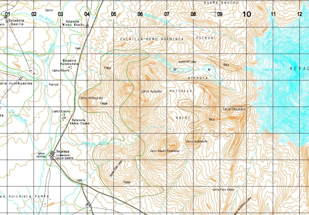
West Side of Tata Sajama, detail from IGM’s pdf version of its 1:50k topo, available online

Digital (or digitized) Maps

There are a couple of options online.  By far, the most interesting is the website of the Instituto Geografico Militar, at http://www.igmbolivia.gob.bo/.  The Instituto is moving quickly to put new products up online.  They now have topographic maps in .pdf format at standard scales of 1:250,000, 1:100,000, and 1:50,000.  They also continue to have available the 1:250,000 in .dgn format, a CAD (computer assisted design) format.  All of Bolivia is covered in the 1:250k scale.  While coverage is pretty good in the 100k and 50k maps, it is by no means complete, so you need to use all these scales to get full coverage of the country.

Comanche, detail from a 250k .dng file available for free on the IGM website - so what's the scale on this map now? 
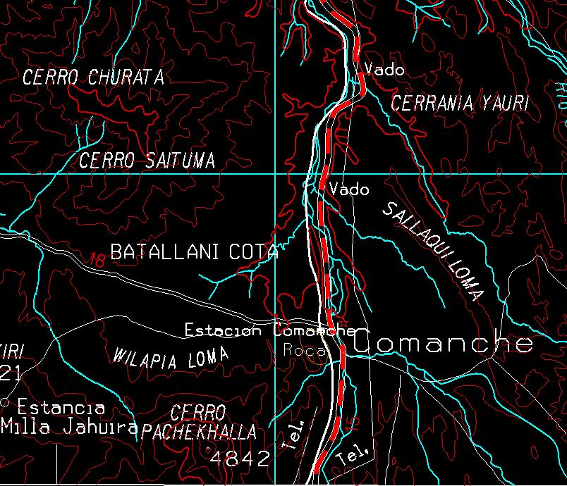
Comanche, detail from a 250k .dng file available for free on the IGM website – so what’s the scale on this map now?

Of course, one of the oddities of mapping digitally is the obsolescence of the whole idea of issuing maps in different “scales.”  By zooming in and out, a digital map can be re-scaled on the fly on your computer or your GPS.  So, what the scale on these pdf versions really means is that they vary in their level of detail, with the 250k maps much less detailed than the 50k maps.  However, that idea breaks down with the very interesting .dgn maps.  These are highly detailed.  Of course, you need to get a specialized program, capable of viewing a CAD file, to see these, and that is where Bentley View V8i comes in.  From Bently View, you can view, zoom, print, or convert to PDF.  These files have much more information than the 250k .pdfs on the site.  In fact, I should compare them to the 50k’s one of these days.  I suspect that they are equally detailed, except possible in terms of elevation lines.  That does mean that generating a pdf from a complete 250k map creates an almost illegible mess.  However, zooming in and generating something like a 50k map is much more useable.

The other site, previously my go-to site for free maps of Bolivia, is the Perry-Castañeda Library Map Collection on the website of the University of Texas in Austin.  The Bolivia Maps are available for downloading at http://www.lib.utexas.edu/maps/bolivia.html.  Besides a variety of country maps, and some maps of La Paz, dating to the 1990s, you can find aeronautical charts at 1:1,000,000 and 1:250,000.  The former has full coverage for Bolivia, and the later has most of Bolivia covered.  Almost all of Bolivia is covered in the 1:100,000 topographical maps, and there are four lonely 1:50,000 topos.  All of these are old, and the dates vary, so I suggest you make a point of looking at the dates and consider the possibility that roads, and some other features, may have changed since the maps were made.

Which Map(s) Do You Need?

With so many maps available, it can be difficult to find the topo map(s) you need, especially since the keys and guides for these maps (at least those provided online) are terrible.  However, I’ve found a website to solve the problem.  Try out http://www.geospatial.com/.  They have an interactive map for finding maps.  You zoom in and then select the area that interests you, and they will give you a list of all the maps they are aware of covering the area.  There will be a lot of “chaff” in there, in the form of British and Russian nautical charts, Soviet Military maps and other assorted oddities, but you should find the IGM’s 50k series right at the top and other IGM maps scattered among the chaff as you scroll down.  After you know what you need, it’s easy to go over the the IGM site and download it.

Paper Maps

As much as I enjoy the modern, digital maps, there is nothing quite so satisfying as spreading your paper map(s) out on a big table and planning your next trip.  For that purpose, the Instituto Geografico Militar can’t be beaten.  You can visit them at the Estado Mayor General, Av. Saavedra #2303, or call them at the phone numbers on their site.  They have a very modern, computerized system, and can find the map you want, and print it out on their plotters, for a pretty reasonable price.  Definitely recommended.  I have not yet explored whether they have the maps that are missing on their website, but my understanding is that full coverage of the country at the more detailed 100k and 50k scales is simply not available.

I’ve seen other good paper maps, but have not found them for sale.  Someone is producing hiking maps with coverage of the main hiking areas of the country, and from what I have seen they look pretty good.  I purchased a couple of maps from the series “Rutas de Viaje/Journey Routes FOV,” but was not impressed.  Although the map sheets are pretty big, much of the space is taken up by advertising and text and the maps themselves are not that impressive.

Software

As I noted above, I use a number of software applications for mapping.

Google Earth and Google Maps are great for generally exploring around and getting an idea of what is where.  You can also create a route in Google Earth and export it for use in your GPS, or open .gdb or .gpx files (among others) in Google Earth to review them against the map.  Google Earth does a fair job of searching for locations.  Google Maps can sometimes find a place that won’t come up in Google Earth.  Another way to search for a location or a feature is to go to Panoramio and search for a photo.  Since the photos on Panoramio all have geographical information attached and are displayed against a map, if you can find a photo of what you are looking for on Panoramio, you can get the latitude and longitude of the place where it was taken for use in finding it on your maps.

I haven’t spent much time with Garmin’s new software, BaseCamp, but I used its predecessor, MapSource, extensively.  BaseCamp is free, and seems to make a good interface for the GPS.  OSM maps load into it just like they did with MapSource, and once you have good maps in it, it is a reasonably useful trip planning tool, as well.

OziExplorer is about the most interesting piece of mapping software I have found.  You can import any map you can get in a .jpg format – scans of topo maps, for example, or conversions from .pdf files (like the maps on the IGM website).  Then, as long as you have the information on latitude and longitude, you can enter it and have a map where you can plot your gps routes and tracks, or plan your next trip.  It can interact directly with your Garmin GPs, or even become a real time gps of itself, if you put it on a laptop, teathered to a gps, and take it into the field.  About the only thing it can’t do (sigh) is upload your topos onto your gps.  This is commercial software, with a price tag of $109, but great commercial software.  Take a look at the index feature, as well.  As you put your maps into OziExplorer, it can create an index page showing the locations of all your maps on a less detailed map.  you can zoom in by going to the more detailed maps, which can also be shown as indexes for the still more detailed maps.  If you have a large collection of digital maps, this is an easy way of keeping track of them (once you carry out the time intensive work of getting the maps correctly calibrated).

Other Software Tools

One problem with digital cartography is the multiplicity of formats for all the different software.  As a result, you are likely to need some conversion utilities.  I regularly use GPSBabel to convert between .gdb .gpx .kml and other formats gps information comes in.  PDF Converter makes it easy to convert .pdf files to .jpg files, though I wish you could convert them in batches.  And if you really get into Open Street Map, you will eventually want to get JOSM, the premiere OSM editor.  Personally, though, I found the learning curve on JOSM to be fairly steep.  And then, one easy cheat to put anything you can show on your screen into .jpg format very easily is the Snipping Tool found in the Accessories Menu under Windows.  As stated above, I use Bentley View V8i to review and convert the very interesting IGM .dgn maps.  I’m not that happy with the results from Bentley View, though, and continue to look for something else.

If you have other/better information on maps in Bolivia or software, please share in the comments below.

Cala Cala (Qillqata) Rock Art

_MG_1018The small, but interesting, archaeological site at Cala Cala, less than 15 miles from Oruro, together with the colonial-era chapel in Sepulturas, along the way, make for a very pleasant half-day trip from Oruro.  If you have a full day for an excursion, you could certainly pack a picnic and spend a few hours hiking around the area.

Cala Cala (sometimes listed as Calacala, Qala Qala in Aymara), or “Rock Rock” in English, seemingly signifying an area strewn with rocks, which is certainly accurate.  What makes this rocky area stand out from the rest of (mostly rocky) Bolivia, are the pictograms (aka pictographs), or paintings of llamas, felines, and humans found in three groupings on the underside of an overhanging cliff.

_MG_1024The area, known as Qillqata (“writing,” in Aymara) to the locals, contains three groupings of figures painted mostly in red, but with a few white and black figures mixed in as well.  They are believed to date back some 2,400 years, according to the sign at the site, and likely were much more extensive in the past, as weathering is clearly affecting the remaining figures.  The site was declared a national monument in 1970.

The area surrounding Qillqata (pronounced kel-cat-a) is made up of semi-hoodoos set around a valley.  Hiking and exploring among the rock formations would be entertaining.

_MG_1012Visiting Cala Cala from Oruro is easy.  You leave town on the Avenida del Ejercito, which turns into the Panamericana when it passes the Avenida Circunvalacion, or ring road.  After passing the airport and crossing the train tracks, you turn left some three miles from the ring road, into the small town of Vinto.  You can’t miss it, as it is overshadowed by the major tin smelter which shares its name.  This smelter, purchased by Swiss multinational Glencore from a previous President of Bolivia, Gonzalo Sanchez de Lozada, in 2005, was then nationalized by current President, Evo Morales, in 2007.

In just a few minutes, you begin to see the Iglesia de Sepulturas, on the other side of the river on your left, and almost three miles from the turnoff, you will want to turn left again to visit the Iglesia.  You do have to ford a stream (though you cross the river on a bridge), but we did that even after substantial rain had fallen, so it should not constitute a serious problem.  The chapel is only a half mile from the main road.  For details on the Iglesia, see La Capilla de Sepulturas.

_MG_1014After returning to the main road, where you will be turning left to continue along your way, you will arrive at the town of Calacala in about 6.3 miles.  You would do well to stop at the store on the main square and ask about access to the site.  A woman from there accompanied us out (in our car), picked up the key from the family living nearby, charged us our Bs10 per person, and guided us.  The site is protected with a fence, complete with several strands of barb wire on top – an unfortunate but necessary addition to the site, given the number of similar places I have seen defaced with graffiti.  This site, while small, and with it’s natural view obstructed by both the fence and an elevated wooden access walkway, is at least not defaced.

It’s only another mile-and-a-half to the site itself.  Beginning in the town, there are good signs to guide you to the site.  Attached you will find a .gdb file with the routes, which you can view on a GPS or on Google Earth, though this route is simple enough that you should be able to find it with minimal assistance.

Tatyana and Aliciya (the budding  photographer)

Tatyana and Aliciya (the budding photographer)

La Capilla de Sepulturas

Side View Showing Bell Tower to the Left and Santa Barbara's Tower to the Right

Side View Showing Bell Tower to the Left and Santa Barbara’s Tower to the Right

The Church of Sepulturas, officially “Señor de San Salvador de Sepulturas,” makes a nice stop on the road from Oruro to Cala Cala.  The town is named for the chullpas (Incan and pre-Incan tombs) which were common in the area, but which are pretty much gone now.  It is now probably best known for the chapel, which was declared a national monument in 1967.

In Iglesias Rurales, Ambassador Philipp Schauer states that the church dates from 1785, which date is on the side portal.  Ambassador Schauer is probably right, though the caretaker of the church claimed it was built about 100 years earlier.

Front View

Front View

The church is built mostly of adobe, with walls about three feet thick and takes the form of a Latin Cross.  The roof is thatched, and according to the caretaker, is double.  The large, square bell tower stands to the right side of the main entryway.  At the right-rear corner of the wall surrounding the church stands another tower, unique to this church, and connected to the patron saint of the town (see below).

Pulpit

Pulpit

This church is quite deteriorated.  In 2006, the company Complejo Metalúrgico Vinto S. A., which operates a tin smelter nearby and was then owned by Swiss multinational Glencore through its Bolivian subsidiary Sinchi Wayra, agreed to finance the full restoration of the church.  Unfortunately for the church and the community, the smelter was nationalized in 2007, and only the repair of the roof was completed.  The community continues to seek a sponsor to help with completion of the restoration.

One unique feature of this chapel is its permanent inhabitant.  You will likely see the owl resting on a rafter in a daytime visit.

_MG_1001

A gate in that right wall leads to a large processional square, surrounded by its own wall and with small chapels in the corners and another small structure, apparently a “capilla miserere” in the center.  Also near the center is a large pillar.  While the local corregidor suggested that the pillar may have had other purposes, Ambassador Schauer reports that it was a “rollo,” used for binding criminals as a way of shaming them publicly.

Santa Barbara (without her sword and tower)

Santa Barbara (without her sword and tower)

Inside is a statue of Santa Barbara, the patron saint of Sepulturas.  Two major, original silver pieces belong with the statue, but are generally kept safe elsewhere.  One is a sword, which she holds in her right hand, pointing up at heaven.  The other is a tower, which she holds in her left.  Together with a small tower outside the church, these two items hark back to the story of the Saint.

Santa Barbara was supposed to have lived in Nicodemia, present-day Turkey, in the third century.  She was the daughter of a a rich pagan, who shut her up in a tower to protect her from the world.  She was converted to Christianity and, after a series of miraculously failed attempts to kill her for her conversion, finally her father was successful in beheading her.  As punishment, he was struck by lighting on the road home after the beheading, and his body was consumed by fire.  According to the chapel caretakers, the sword held by the statue symbolizes the lighting which struck her father.  From the lightning story, Santa Barbara has become the patron saint for people working with explosives and fire, such as miners and artillerymen.  Her connection to mining and fire is likely the reason for her to have been chosen the patroness of Sepulturas, a mining and smelting town.

The "rollo"

The “rollo”

Santa Barbara has fallen out of favor with the Catholic Church in recent years (though she remains very popular with Orthodox Christians).  In 1969, Pope Paul VI ordered the traditional date of Santa Barbara’s martyrdom removed from the liturgical calendar on the grounds that there was little reason to believe that the story of her life and martyrdom had any basis in history.  That has had little impact on the faithful of Sepulturas, who continue to celebrate the Saint’s day as their most important local holiday, holding their “Gran Feria,” including a running of the bulls, every year on December 4.

Sepulturas is less than 10 miles from Oruro, on the road to Calacala.  Directions and a .gdb file for the whole trip, including the turnoff to Sepulturas, are covered in the post on the Rock Art at Calacala.

Tour Guide of Iglesias Rurales: La Paz y Oruro

003Despite its focus on chapels and its brevity, German Ambassador Philipp Schauer’s guide to rural churches (Guía turística de/Tour guide of Iglesias Rurales: La Paz y Oruro, by Schauer, Philipp, Teresa Gisbert) is my favorite printed guide to the Altiplano.  With lots of maps and photos, Spanish and English directions to, and descriptions of the churches, and information about other sites nearby, this guide has the most detailed information I have been able to find on selected parts of the altiplano.

Of course, the book is absolutely indispensible for anyone interested in the altiplano chapels, architecture, or colonial art.  However, the directions, maps and descriptions of nearby sites also make it useful for explorers who are not so tightly focused on the churches.  The book will get you to many sites which are too small or isolated to be covered in the large commercial guidebooks, but which are nonetheless small gems of culture or nature.

Given the isolation of many of the churches, the book is necessarily oriented to the traveler with an auto.  For the average tourist on the Macchu Picchu-Titicaca-Salar circuit, that may not be helpful, but for anyone who is interested in seriously exploring the altiplano, the only way to do that is in a private vehicle.  If that is your intent, you need this book.

The book is bilingual, which effectively reduces its length further from 96 pages, but makes it accessible to local tourists, as well as English speakers.

The book is available online from numerous sellers for $45.  I have not seen it recently in bookstores in La Paz.

004It is worth noting that Ambassador Schauer has recently published another tome, similar in format, on Santa Cruz Department (not including Santa Cruz City, itself).  If you are thinking of traveling in that region, and especially if you are planning a visit to the Chiquitania, you certainly will want to pick up Atractivos turisticos en el departamento de / Tourist attractions in the department of Santa Cruz.

Caquiaviri and Pacajes Province


Destination Caquiaviri

Destination Caquiaviri

Caquiaviri is a small town on the road to Charaña, which is on the border with Chile and Peru, north of Tambo Quemado.  It’s a great destination for a day trip from La Paz, and it will soon be an even better destination.

According to German Ambassador Philipp Schauer, in his book, “Tour Guide of Iglesias Rurales: La Paz y Oruro” (Iglesias Rurales = Rural Chapels), “The chapel in Caquiaviri (The chapel of San Antonio Abad) is one of the masterworks of sacred architecture on the Altiplano.”  It was built in the 1560’s, making it one of the oldest churches in the region.  In the 1730’s, three altars and a pulpit were added, decorated in baroque mestizo style.  It also harbors 30 paintings.  Like most paintings in the Altiplano chapels, these were probably intended more for didactic, than artistic, purposes.  The large painting of the “Triumph of the Dominican and Franciscan Orders” gives a hint at the history of the church, which was built by the Franciscans, but taken over by the Dominicans in 1581.  (By the way, get Ambassador Schauer’s book. At most, I am giving you a taste of the great information and hints from the book.)

Caquiaviri itself apparently pre-dated the arrival of the Spanish.  It was a capital under the Incan Empire, and was on the road to Cuzco.  Today it is a small town, but a cute one, set against a hillside.


Getting There

From El Alto, take the road (carretera) La Paz-Viacha (Avenida Tihuanacu) south.  From its intersection with Avenida Litoral, it’s about 10 miles to Viacha.  You hardly even leave the urban area, as the growth of El Alto threatens to extend into Viacha, which means that you will likely be fighting traffic all the way, and even if you aren’t, watch out for the “shock busters” or “donkey backs” as the Bolivians call them, the speed bumps which are laid across the road at frequent intervals.

You can find directions in this .gdb file, which can be opened in Google Earth or used directly on your GPS.

(click to enlarge)

(click to enlarge)

Viacha, itself, is a bit of a difficult passage right now.  You want to continue on straight through town after jogging to the right, or west,  by some three blocks, past the central plaza.  However, the main street out of town, the continuation of Road 19 which brought you from El Alto, has been completely torn up for repairs (utility installation?) for most of the past six months.  If it has been completed by the time you get there, that will make the passage easy.  Otherwise, you probably need to stop and ask how to get out of town towards Coro Coro.

The work is over, at this point, as you have left the urban area behind, and the trip is pleasant.  For the next 18 miles you pass through rolling hills.  Emerald green in the rainy season, they turn various shades of brown and red when the vegetation dries up.  There are also several small lakes and ponds on which you are likely to see a variety of water birds, including flamingos, if you are lucky.  At 15 miles, you pass through a customs checkpoint.  The principle illicit activity here seems to be smuggling gasoline, so if you don’t look like a smuggler, you should get through without a hitch.  That said, you’ll probably need to stop and chat with the officers for a few minutes.

The First Bridge

The First Bridge

Three miles further, you come to the first of a series of bridges which are under construction.  Although the stream here hardly exists in the dry season, if there has been recent rain you won’t want to try to ford it.  Happily, the local population have come up with a temporary solution while waiting for the government to complete the bridge.  They have built their own temporary bridge, for their own use.  You will pass over two such bridges, the second soon after the first.  They are narrow, and have no railings.  I crossed them in my Jeep Grand Cherokee, but I would not try it in a Suburban or a Land Cruiser; they are just too wide and heavy.  Actually, before you can cross them you first have to negotiate with the locals.  To me, their initial line was that “we built this bridge just for ourselves, you can’t cross.”  The guy in charge seemed a bit surprised when I offered to pay, but didn’t take long to offer a price – actually, several prices.  First he said, Bs20, then Bs40, and finally settled on Bs10, all before I could even enter into bargaining.  I would have paid any of those prices and felt good about it, just to know I was contributing to such a virtuous effort on the part of the local population.  I suggest bringing along some kind of small gift for the locals standing around there (I always carry a supply of decorative pins, myself, for such occasions).  They will certainly appreciate it.

Oops!

Oops!

Shortly after crossing the first bridge, you will find yourself at the second.  We arrived at this bridge just in time to see a truck, and then a bus, attempt to ford the river to the side of the bridge (they wouldn’t have fit on the bridge, itself).  Both vehicles got stuck in the clay we were told forms the bottom of the river.  We forded the river ourselves, hardly more than a small stream, when we were here in the dry season, though.  This bridge is actually worse than the first, seemingly made of leftover construction materials and stones and mud picked up at the location.  You will find yourself paying again (it’s maintained by a different community).  There are lots more crossings, but at least when we were there, in January, these were the only two that were really problematic for a serious 4WD vehicle.  None of them would be a problem in dry season.  And, more importantly, the bridges all seem to be well underway, so there should be fine cement bridges at all the crossings in a matter of months, making this an easy trip.  From the looks of road crews grading the road in between the bridges, it looks like they plan to pave the road, too.

Crossing the bridge; Tatyana was shaking so bad with fear for me that she couldn't hold the camera steady

Crossing the bridge; Tatyana was shaking so bad with fear for me that she couldn’t hold the camera steady

For now, though, the pavement extends for less than half mile from the second bridge before giving way to a dirt road.  It’s a pretty well maintained road, so that’s not a huge problem, but you will, of course, make much slower progress.  The terrain changes, as well, from rolling hills and small scale agriculture, to much rougher broken terrain; the scenery is wilder, and the occasional houses take on the colors of the surrounding soil, mostly reds and purples.  Some ten miles from the bridge, you will see a small village with a pretty large, maintained-looking church, off to the left of the road.  This is apparently the Comunidad Labra.  Just over the next ridge, is an outcropping of minerals being mined on a small scale.  This is the first of several mineralizations along the road, and explains the large trucks you’ve been seeing as you drive.

South, towards Canambari

South, towards Canambari

Another mile down the road and one more river crossing, and you come to an unmarked turnoff to the south.  This dirt road extends to the small town of Canambari, and the Coro Coro-Achiri road, which could make a loop of the trip.  One could also make it a loop by continuing south from the second bridge, instead of crossing it, to Comanche, then on to the mining town and provincial capital Coro Coro and around to Achiri.  I haven’t done that trip, but will eventually.

Another eight miles from the turnoff toward Canambari, is Caquiaviri, nestled up against the hillside to the southwest, the chapel prominently overlooking  the town.  We were there on January 21, and the local fiesta, San Antonio de Abad which reportedly begins on the 17th, seemed to be just coming to a close.  It is reportedly celebrated with a running of the bulls.

From Caquiaviri to Achiri is another 30 miles, but we’ve only made it to Vichaya, about half way.  The terrain changes significantly after Caquiaviri.  From the bridge until Caquiaviri, it is rough but seemingly relatively fertile.  Sheep outnumber llamas and small scale agriculture is in evidence.  After Caquiaviri, it becomes noticeably dryer and less arable.  Sheep are no longer visible, and llamas appear only occasionally.  Old mines and new are in evidence on the sides of the road.  Some seven miles out of Caquiaviri is a very noticeable set of eroded washes, mostly on the south side of the road, which is interesting for the gorges cut into the plain.  If you get out and walk around a bit, you will likely find some strange square and rectangular stones which weather out of the dirt, as well as old pottery shards.  This area must have been populated sometime in the past, but all that’s left are the shards.

Viacha

Vichaya

Another mile and a half down the road you will come to the small mining town of Vichaya.  Vichaya appears to be experiencing a mining boom.  There are operating mines scattered all over the area, and many have large trucks parked next to them, being loaded with the minerals being taken out of the ground.  Next time I’m there, I’ll stop and find out what it is they are mining.  We got another four miles beyond Vichaya before coming to another bridge-to-be.  In this case, the detour around the construction site was a field of mud, and we decided to forego the risk.  When we get the chance, though, we’ll be heading back out this way to find Pirapi Chico and Cerro Pirapi (marked in the .gdb file) where, according to Ambassador Schauer, one can find more than 30 stone chullpas, some dating to the 14th century, and a fortress which may have served the locals in their resistance to the Inca invasion.  Definitely a place I want to explore.

To Lagunas Aiuan Khota, Kunk Huikara, and Mikhaya

A Pond, with Laguna Mikhaya and the Cordillera Behind It

A Pond, with Cerro Mikhaya Behind It

This is one of the places I used to travel to at least monthly to hike, fish, camp, and just relax.  It’s quite changed, now.  All the “lagunas” have been dammed, and in several cases, they are fundamentally different from what they used to be, with their surrounding bofedales now almost entirely underwater.  That said, especially for someone who doesn’t have to compare the place with what it was like 25 years ago, this is a beautiful valley which can be reached quickly and easily from La Paz.  Definitely worth exploring.

This trip starts where the drive Up The Khallapa River Valley ends.  Use the directions in that post to get to the starting point for this extension.

About 2.3 miles beyond your first sighting of Challa Pata, and after a couple of switchbacks over the valley of the Rio Uma Pelada, there is a turnoff to the right which will take you, in only a half mile of rather poor track, to the fairly impressive Kormiri Falls.  The falls are worth the detour, and if the road is not one you want to brave, the walk is short and the climb (about 300 feet, more or less smoothly distributed over the half mile) is not too challenging.  From the parking spot below the Kormiri falls, it is a very nice 2.7 mile hike up to Laguna Serkhe.  The roads and trails to Laguna Serkhe are described in another post, To Serkhe Kkota.

Cactus Flowers Are a Surprise at 15,340 Feet

Cactus Flowers Are a Surprise at 15,340 Feet

Only about a half-mile beyond the turn-off, you will come to Laguna Aiuan Kkota. This long lake is not on the old maps and I don’t believe it existed before. It is the result of damming the Uma Pelada River and, if memory serves, flooded a large area of bofedales.  Just beyond the dam that holds back the Aiuan Kkota is another turnoff to the right.  This road takes you all the way to Laguna Serkhe.

Another Cactus Flower

Another Cactus Flower

Continuing on the “main” road,  you follow the shore of Aiuan Kkota for a little more than a mile.  When you leave the laguna behind you are only about another mile from the end of the road, at Laguna Kunk Huikhara.  The road ends at a small building which is under construction. The grafitti on the side of the building insults the municipality, which presumably is building it. Unfortunately, either the builders or other people who have been in the area (or, more likely, both) have strewn trash around. It’s a bit sad.

If memory serves, this is where I used to come to fish 25 years ago.  At that time it could only be reached by hiking and I never saw anyone else there. Now you can’t escape people here.  Even if you are alone, the building has been built to overlook the lake, so you never really feel yourself completely away from civilization. Another couple of things I noticed and didn’t like here.  First, it seems that they have not finished with the road, and are working to extend it further.  Second, someone has dug a channel along the side of the lake. It seems designed to keep water from seeping into the bofedales to the right of the lake. Then I noticed an area where someone is digging the bofedales up and piling up the earth, apparently to ship it out.  Someone is apparently mining the bofedales for top soil.  Another reason to oppose the construction of roads into the high mountains.  These bofedales developed over centuries, and drying them out and then digging them up will destroy them for many years to come, maybe forever.

Laguna Mikhaya

Laguna Mikhaya

From the small building you can hike on up to the last of the lagunas, Laguna Mikhaya. It’s only a two mile hike, with an increase in altitude of only about 600 feet.  Looking on Google Earth and in the old maps from the Perry-Castañeda Library, it appears that one could continue the hike up over the pass and down again to Laguna Chara Charaui, Laguna Laram Kkota, and down Rio Acero Marca to connect to the road to Chulumani.  The trek appears to be about six miles.  That would be a great adventure.

Above Laguna Mikhaya

Above Laguna Mikhaya

Mapping

Attached is a .gdb file with all the routes and waypoints. You can find topographic maps (though somewhat outdated) covering the area at a 1:100,000 scale for free in the Perry-Castañeda Library Map Collection of the University of Texas archive at Austin. The relevant sheets are La Paz (South), La Paz (North) and Chulumani. If you load these maps into OziExplorer, you can also load the .gdb file (it has to be converted to .gpx first) which will plot the routes on the topo maps.  Pretty cool.

To Serkhe Kkota

_MG_9776This is a great little trip, especially if you hike it.  And since there is also a road, you might be able to get someone to drive and that way you only need to hike in one direction.

Laguna Serkhe Kkota (Q’uta is Aymara for lake, and gets masacred in place names throughout this part of Bolivia.  I’ve seen it as Kkota, Khota, Kota and Cota.  Serkhe, though, is a mystery.) is a beautiful lake up one of the branches off of the Khallapa River Valley.  It’s a large lake sitting at 15,750 feet of altitude.

Upper Portion of the Kormiri Falls

Upper Portion of the Kormiri Falls

There are two routes to Serkhe Kkota.  Both start Up The Khallapa River Valley, as described in that post.  I’m attaching a .gdb file you can use to view the routes on your GPS or Google Earth.  Continuing on past Represa Hampaturi, you will find a small, poor road branching off to the right.  The turn is at about 2.3 miles beyond your first sighting of Challa Pata, and after a couple of switchbacks over the valley of the Rio Uma Pelada.  This road will take you, in only a half mile of rather poor track, to the fairly impressive Kormiri Falls. Beyond the falls the road looks more challenging than I am interested in, but the falls themselves are worth the detour, and if the road is not one you want to brave, the walk is short and the climb (about 300 feet, more or less smoothly distributed over the half mile) is not too challenging.

Profile, Laguna Serkhe HikeFrom the parking spot below the Kormiri falls, it is a very nice hike up to Laguna Serkhe. That said, the hike is definitely steeper, in places.  In 2.7 miles you gain some 1,100 feet of elevation, and some parts, especially at the beginning, are a bit of a scramble.

(click to enlarge map)

(click to enlarge map)

The hike takes you over the waterfall and then through a lovely valley past a couple of llama herders’ homes.  At the top of the waterfall is a mini-slot canyon with deep pools at the bottom, which would be very enticing, if you didn’t know that the water is recent glacier melt and probably not much above 32 degrees Fahrenheit (that’s 0 degrees Celsius, for you metric-lovers).

_MG_9718

Gumercindo, his wife Lucia, and daughter Jocelyn tend Gumercindo’s uncle’s llamas, earning a few animals to start their own flock. They moved up into the mountains from the shore of the Titicaca to earn their livelihood, but on my last trip their neighbors told me that they had returned to the lake.


The drive is beautiful in its own way.  Continue on along the main road, passing right under the dam that holds back Laguna Aiuan Kkota.  Just after climbing out from under the dam, you find another right turn.  This road is slightly better than the first, perhaps, but I suppose that is a matter of taste.  It climbs up over the ridge between the two valleys, so you get some breathtaking views (or long potential drops, as some might think of them).

Tatyana, Aliciya and Myrna enjoying the lake

Tatyana, Aliciya and Myrna enjoying the lake

On the other side of the ridge, two miles from the turnoff, you will come to a gate and a small, unnamed, reservoir.  The gate has been open whenever I have been there, and one of the locals told me it was constructed by miners prospecting above, but that locals objected to it being locked, so it never is.  From the gate, the road continues on for another mile to Serkhe Kkota.  There is a well-used camping spot on the side of the road marked in the .gdb file, and this would not be a bad place to spend a night or two.  From the looks of the canyon on Google Earth, one could probably continue up the canyon to the glacier perched on the side of the mountain to the east of the lake.

The lake, like most up here, is habitat for a variety of waterfowl.  Among those I have been able to identify have been Andean Geese, Giant Coots, and Andean Gulls.

More photos are available at: Larry Memmott Photography.

Andean Geese

Andean Geese