Site menu:

Tiwanaku Church

_MG_2998

If you are going to Tiwanaku, you should certainly visit the town and its church.  It is certainly worth noting that most of the stone used to build the town, and all of that used in the church, was taken from the Tiwanaku ruins.  For modern sensibilities, that would be a crime, but I suppose that back when it happened, it seemed only sensible.

The Tiwanaku church is covered in Ambassador Phillip Schauer’s excellent book, “Tour guide of Iglesias Rurales,” which you should certainly buy if you don’t have it yet.

The Tiwanaku church, dedicated to St. Peter, was completed in 1612.  It is all of stone, and two major statues from the Tiwanaku site adorn the front of the church.  Unfortunately, the “cages” placed around the statues, undoubtedly to protect them, make it difficult to really appreciate them.  Take a good look at the workmanship of the church.  The water spouts, for example, are puma heads carved in a style similar to that of Tiwanaku.  you can’t possibly miss the stained glass figure on the front of the building.

For full directions to this and other sites in the area, see Tiwanaku, Colonial Churches and Natural Arches.

Laja and It’s Church

_MG_2988Laja was founded as La Paz on October 20, 1548 by Alonso de Mendoza.  It lasted for three days, as the city was transferred to its current location on October 23.  Laja remained an important location and the first cathedral in Bolivia was built in the mid-17th century.  It is an imposing stone building with two bell towers.

A short stop in Laja is certainly worthwhile.  See the monument to the founding of La Paz in the center of the plaza and, if you are lucky, maybe you can get in to see the interior of the church (I have not seen it.)

Laja is a nice stop on the way to or from Tiwanaku.  For directions and other interesting sites in the area, check out Tiwanaku, Colonial Churches and Natural Arches.

Tiwanaku, Colonial Churches and Natural Arches

Gateway of the Sun, Tiwanaku

Gateway of the Sun, Tiwanaku

Tiwanaku is mandatory, even if you are in Bolivia for only a few days.  It is the premiere archaeological site in the country and provides an opportunity to learn about the longest lived empire in South America.  On the way to Tiwanaku, you can visit the first cathedral in Bolivia and the site of the founding of La Paz.  Just beyond Tiwanaku is the Titicaca port town of Guaqui, with its own colonial church, a couple of natural arches carved by time and weather from sandstone, and the town of Jesus de Machaca with another colonial church, quite different from the others.  The short drive from Guaqui is a quick introduction to the altiplano and also features nice views of Lake Titicaca.

Tiwanaku is only 1-2 hours from La Paz, so it is an easy day drip.

Church in Laja, first cathedral of Bolivia

Church in Laja, first cathedral of Bolivia

Take Panamerican Highway #1 west southwest leaving El Alto.  This is the road to Desaguadero and the Peruvian/Bolivian border and is paved all the way there.  Only some 12 miles from the intersection where Highway #2 splits off to the northwest, you will arrive at Laja.  Either coming or going, take a few minutes to visit the initial founding place of La Paz and the first cathedral in the region.

There is a toll booth just past Laja.  The turnoff to the right for Tiwanaku is only another 21 miles down the road.  The site itself is about a mile down the road and to the right, and is well signed.

Tiwanaku Church

Tiwanaku Church

After leaving Tiwanaku, you should visit the Tiwanaku church in town, which is about half a mile further.

On the way out of town, watch for the sign for Pumapunku on the left.  Pumapunku is part of the Tiwanaku site, but I have not yet visited it.

The Chapel in Guaqui

The Chapel in Guaqui

Another 11 miles from the turnoff to Tiwanaku is the turnoff, also to the right, to the Titicaca port town of Guaqui.  Here you can visit the colonial church and drive out to the port, which is a transshipment point for cargo coming across the lake onto the railroad spur that runs from Guaqui to La Paz.

Just beyond Guaqui is a police checkpoint.  The focus here may be smuggling or drugs, as when I have been here there have been many trucks parked to the side of the road, likely for inspection.  About 3.5 miles west of Guaqui a dirt road veers off to the south.  The road climbs a ridge south of Lake Titicaca, and there are nice views out over the lake.

One of the natural arches

One of the natural arches

On the left side of this road, at about 2.3 miles from the turnoff, two natural arches have been carved in sandstone fins just a short walk off of the road.  They make a short, fun, walk up the hill and a nice natural counterpoint to all the man-made architecture which is the focus of this trip.

_MG_3012Another 14 miles down this dirt road will take you to Jesus de Machaca, with another major colonial church.

Attached is the usual .gdb file with location information on this trip.  It will open in Garmin’s free Basecamp (or MapSource) software or Google Earth to allow you to review the trip before heading out.  Of course, the best way to use it is downloading it onto your GPS for turn-by turn directions.

Tiwanaku

Alex and the Gateway of the Sun

Alex and the Gateway of the Sun

The trip to Tiwanaku is a “must-do” excursion from La Paz.  The remains of the capital of the longest-lived empire in South America is something you don’t want to miss.  The ruins are impressive.  The history behind them is even more impressive.  I’m not going to get into all of that here, so you definitely want to get a good guide book and read about the history and the place, perhaps during the drive out.

Tiwanaku (also spelled Tiahuanaco, Tiahuanacu, and probably in several other ways, as well) was the capital of a huge realm, covering about half of present-day Bolivia, southern Peru, northwestern Argentina, and about half of Chile.  It’s rise began in about 100 BC and control over the Titicaca basin was established by about 400 AD.  The empire continued to expand and lasted until sometime after 1000 AD.  Expansion of the empire was, in part, by conquest, but some experts believe that many peoples joined this very prosperous empire voluntarily, as well.

Aliciya in the Semi-Subterranean Temple

Aliciya in the Semi-Subterranean Temple

The prosperity and success of the Tiwanaku culture was based, first and foremost, on agricultural innovation.  The inhabitants came up with a system of raised fields which not only avoided flooding, it also allowed them to control the salinity of the soil, minimize the impact of drought and moderate temperatures in the fields.  As a result, the altiplano region around Tiwanaku was more productive during this period then ever before or since, allowing the empire a level of prosperity not previously seen in the area and enabling the financing of wars of conquest or just enticing other groups to join up to this expanding, highly prosperous civilization.  We looked for remnants of the raised fields, which some authors say exist, but have not found them.  If you find any, please leave the location in the comments.

Some archaeologists believe that the heads on the walls of the Semi-Subterranean Temple represent people conquered by the empire

Some archaeologists believe that the heads on the walls of the Semi-Subterranean Temple represent people conquered by the empire

Tiwanaku, as the site of the capital of the empire is now known, is an impressive place to wander around.  You can hire a tour guide to show you the site and tell you the stories (some of which may be apocryphal) , or you can just wander through it yourself.  You certainly cannot miss the Gateway of the Sun or the Semi-Subterranean Temple

There are two museums at Tiwanaku, and both are well worth visiting.  The “Ceramics Museum is by far the most interesting, with far more than ceramics covered.  There is an interesting display on the raised fields and some metalcrafts, including some gold.  The other museum is sadly crumbling, but you should still go in to see its one display, a huge statue from the Semi-subterranean Temple.

Another portion of the Semi-Subterranian temple, with the entrance into the main temple in the background

Another portion of the Semi-Subterranian temple, with the entrance into the main temple in the background

Given that the inhabitants of Tiwanaku lacked a written language, we have no way of knowing whether Tiwanaku was the name locals gave their city or empire, is a term others had for them, or was invented later.  We also know little about why this successful empire crumbled, but crumble it did, and well before the rise of the Inca Empire.  Some archaeologists hypothesize that a severe, multi-year drought may have overcome even the ability of the raised fields to produce at levels necessary to sustain the empire.  This seems a reasonable explanation, as it might also help to explain why the system, which had worked so well, was abandoned.

Tiwanaku has become a site for “traditional” celebrations of various types.  Last year the Vice President of Bolivia was married in a ceremony here.  Each year Aymara New Year is celebrated here, as well.

Tiwanaku is only 1-2 hours from La Paz, so it is an easy day drip.  There are a number of other visits you can undertake in the area, as well.  For directions and links to other sites in the area which you should not miss, see Tiwanaku, Colonial Churches and Natural Arches.

Alex Is Here!

Alex got here Thursday morning and we’ve been having a good time since then (even though work has been completely insane).  Friday night we went to the video taping of a concert by Bolivian metal group Armadura at the Ministry of Culture.  It was a blast.

Saturday we went down to the Valley of the Moon (Valle de la luna) for a walk, and then today we went fishing at a high mountain lake near La Paz.  Here are a few photos.

_MG_2978

_MG_2981 _MG_2982 _MG_2983 _MG_2984 _MG_2986

Ulupika!

Well, the blog is basically about anything I want to write about, right?  And I’ve never written about food, but that’s no reason not to start now.  Bolivian food, or at least Bolivian ingredients, seem to be a bit in vogue right now.  Quinoa is all the rage in the U.S.  The New York Times is sharing its quinoa recepies.  And now we have Gustu, a high-flying La Paz restaurant by the co-owner of the number one ranked restaurant in the world!  Gustu, which uses exclusively Bolivian ingredients (you won’t find French wine there, as a result) has been reviewed on Bloomberg, as well as in the Times.

So, I’m going to make a nomination for Next Bolivian Breakthrough Ingredient.  My proposal is the ulupica!

Ulupika

Ulupika

The ulupica looks like a berry, but be wary.  It is actually a tiny, round chili pepper.  Quite likely it is the granddaddy of all chili peppers, the original pepper from which all others evolved (or were developed).  The ulupica (from the Aymara ulupika, latin Capsicum cardenasii) grows wild in Bolivia.  Whether picked green or allowed to mature to orange or red, it is a tiny ball of fire.  In Bolivia it is often used with kirkiña, a Bolivian herb, and tomatoes to create llajua, a hot sauce for use on meats, bread, and anything else.  Gustu is serving an interesting cocktail based on llajua and the Bolivian grape-based spirit, Singani, but they are (incomprehensibly) using locoto peppers (Capsicum pubescens) for the drink, rather than ulupica, a big mistake in my view.

With my finger, to give an idea how small these fireballs are.

With my finger, to give an idea how small these fireballs are.

Tinku Territory (Sucre to Oruro)

Llama in the highlands

Llamas in the highlands

Every corner of Bolivia has its own mysteries.  On the way back from Tarija, we decided to travel from Sucre to Oruro across the mountains, rather than circumnavigating them through Potosi, as is usual.  This is NOT a shortcut.  Though the route may look shorter on a map, the serpentine path and bad roads mean it will take several hours more to travel than the road through Potosi.  After a few stops to rest or to explore a bit, this will definitely make for a long day trip.  It certainly might make sense to plan on an overnight in Oruro.  The trip is very worth it, though, if what you want to see is yet another spectacular extension of Bolivian landscapes and another interesting, isolated, indigenous people.
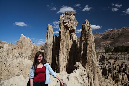
Wild, rocky country

Wild, rocky country

The mountains between Sucre and Oruro are inhabited by Quechua people who still observe the Tinku tradition of ritualistic combat.  I had seen representations of Tinku tradition in the Carnival of Oruro and the Entrada Universitaria in La Paz.  These are intricate indigneous dances by dancers in colorful costumes set to native altiplano music with a strong, almost martial, drum beat.  The Tinku dance troops are always croud pleasers.

What I didn’t know was the source of the dance.  It is actually a representation of the ritual fights which are staged as an offering to the Pachamama (the earth goddess).  The offering consists of the blood spilled by the fighters and, sometimes, of the lives lost in the fights.  Take a look at the video below for a nice Al Jazeera report on the Tinku ritual.  A friend whose father is from this region told me that the fights are now much less bloody than they were in the past when participants often carried stones in their fists as a way of giving their punches an extra wallop.  Note in the video the confiscation of weapons by the police in an attempt to reduce the “efficiency” of the violence.  Tinku festivals are said to occur in May in Macha and Revelo (along our route).

[youtube]http://www.youtube.com/watch?v=sTSTojpCZhs[/youtube]

A few days later I had the opportunity to overfly part of Tinku country (north of Ravelo and down to Sucre).  I shot a few pics with my cellphone, and despite the lack of quality, I think they give an interesting idea of the ruggedness of this territory which is impossible to understand from still photos from the ground (click on the thumbnails to see the whole photo).

IMG-20130417-00027

IMG-20130417-00017

IMG-20130417-00018

IMG-20130417-00025

This is also reportedly an interesting area for textiles.  The traditional textiles of the region tend toward dark colors, with red images of animals and other motifs on black or brown backgrounds.  Unfortunately, we were short on time and could not stop to look for textiles.  Yet another good reason for a return trip.

Traveling the Road

Not one of the wilder stretches of road

Not one of the wilder stretches of road

The first point to make about this route is one that should be made about every road in Bolivia:  You will be well served by asking someone knowledgable about the route before you set out.  Road conditions in Bolivia sometimes change from one day to the next and warning signs should not be expected.  In fact, our trip was affected on both ends.  Major road construction just at the outskirts of Sucre delayed our departure for more than an hour.  Then, getting toward the other end of the road (at about 6:30 pm) we found it had officially closed to traffic at 6:00 pm for all-night repairs of multiple landslides caused by recent rains.  We were allowed to pass, but driving through multiple landslide repair zones with major construction equipment operating in the total blackness of night is really an unnecessary adventure.  By the way, this is a trip I would not take during the rainy season, and this year (2013), I recommend giving road crews another month or so (until May) to clear out the damage from this rainy season.

Route Map (click to enlarge)

Route Map (click to enlarge)

Getting out of Sucre was a challenge for us, but once the road is paved, it should be a cinch.  You leave town toward the north, passing by the airport on Avenida Juana Azurduy de Padilla, which is also highway 6.  At present, and after getting past the construction zone near Sucre, the road is good, new pavement for about the first 17 miles.  Of course, when you travel there is likely to be more pavement and the construction zone may well be further along.  Definitely ask before going or road closures may be a serious problem for you.

Almost as soon as you leave Sucre you enter the cordillera.  The terrain is broken, almost badlands, and you will be climbing and descending between 9,500 and 11,000 feet of altitude for about the first 40 miles of the trip (measuring from the airport).  One of the interesting aspects of traveling through this area is that the altitude, combined with the latitude and an apparently somewhat more humid climate than is usual in highland Bolivia, combine in this region to create scenery similar to an alpine region in a temperate climate — something more similar to the Colorado Rockies than we are accustomed to here in Bolivia.  The deciduous trees of the lower elevations tend to transition to pines as you approach 11,000 feet.  Where a bit of flat land is available, the locals have often planted corn, or even wheat.

Pine woods are not all that common in Bolivia, and a bit of a treat.

Pine woods are not all that common in Bolivia, and a bit of a treat.

We stopped for lunch after some 23 miles at a rocky low pass before reaching Ravelo.  At the top of the hill was what may be (or have been) a ceremonial location, with a number of large piles of stones.  On the other hand, maybe it was just an attempt to clear the land for planting.

Lots of flat rocks make good tables at the spot we chose for our picnic

Lots of flat rocks make good tables at the spot we chose for our picnic

Aliciya always enjoys climbing on rocks

Aliciya always enjoys climbing on rocks

At about 30 miles (measuring always from the Sucre Airport) you arrive in Ravelo, a small town, even if it is the most important of the area.  It’s a small town surrounded by agricultural land.  After passing through Ravelo the main road cuts off to the south of that which is marked on Google Earth and some other maps (Open Street Map has this right, though).  Apparently, this is the result of the ongoing road construction in the area, but it is not noticeable to the driver.  If you follow what looks to be the main road, you will find your way.

Chapel of

Chapel of Khara Khara

The road continues to climb slowly after Ravelo, picking up about 1,000 feet to 11,740 over the next 20 miles, where you will come across the small chapel of Comunidad Khara Khara.  We didn’t have time to stop, but the chapel looks old, despite the tin roof.  Still, the age of adobe buildings can certainly be deceptive.  Signs are scattered along the road promoting the irrigation and other projects of the Government of Bolivia and of USAID, the U.S. foreign assistance agency.

Hoodoos

Hoodoos

At about 55 miles, the road begins to climb again in a more serious way.  Starting at 11,280 feet, the road climbs some 3,000 feet over some 30 miles.  At the beginning of this climb you will come upon some interesting “hoodoo” type rock formations.  At 75 miles there is a turnoff to the left.  Many maps show this as the main road, and it appears to be shorter than what look, on the ground, like the more important road.  Continuing straight along the road takes you to the mining town of Colquechaca in another 20 miles.  Colquechaca (“Qullqichaka” in Quechua which reportedly means “silver bridge”) is officially the highest city in Bolivia, at  more than 13,500 feet of altitude.  Obviously, this designation is highly dependent on the definition of “city” used.  With a population of less than 2,000 persons, some might dispute the use of the term.

Colquechaca

Colquechaca

We had to rush, as we were racing against the dark, but Colquechaca looked like an interesting town.  We were there on a Tuesday, and the town market was in full operation.  There were a lot of local good, many which looked hand-crafted, on display.  I’d like to stop there again some time and wander a bit.  The city is built around a silver mine, which is apparently functioning, though the region around is clearly dedicated to agriculture.

The last five miles into Colquechaca is a descent of some 750 feet, and the decent continues through and beyond the town.  Now you are driving south down the valley of the Rio Colquechaca to Macha, only about 12 miles away, but some 2,000 feet lower.

The stream rushing down the canyon from Colquechaca was running an ugly shade of brown when we were there.  I imagine it is the result of the mining operations.

At about the 100 mile point a nice new bridge has been constructed to cross the river and enter the small town of Rosario.  The bridge is so new and nicely built that you may be tempted to think that is the main road, but unless you want to visit the town, keep going straight down the valley on the right side of the river.

This elevation profile covers the whole trip beginning some three miles beyond the airport

This elevation profile covers the whole trip beginning some three miles beyond the airport

You will recall from the video above that Macha is one of the centers of Tinku tradition.  Here the canyon does an about face and heads north-west, with the river growing from numerous tributaries to become the Rio Grande.  About another 12 miles of easy downgrade gets you to Pocoata, at about 11,100 feet, but from Pocoata you turn out of the Rio Grande valley and begin a set of three ascents to take you finally over the Andes and onto the Altiplano.  First, is a climb up to 12,436 feet over about 6.5 miles.  Then, after dropping back down to 10,800 feet over eight miles, you climb again, over about 16 miles, this time to almost 13,000 feet.  That’s not the end of the climb, though.  After dropping back to 12,150 feet over the next seven miles, you begin the final ascent, a very respectable climb to 14,166 feet of altitude at the pass, some 20 miles further on and 176 miles from your starting point.

Highlands

Highlands

Our real adventure began in Pocoata.  We arrived there at about 6:30 pm, concerned that darkness was coming on fast and worried about traveling in the dark on these rough roads.  We stopped in town to ask about the condition of the road in front of us, only to be told that it had closed at 6:00 pm.  They were repairing the road in the dark.  Given the choice of taking our chances on the road, versus a long, cold night in the jeep, we decided to continue.  We spent the next two-and-a-half hours traveling only 40 miles in the pitch black darkness, passing by huge trucks, excavators, graders and other road construction machinery which was working to repair the numerous places along the road which had either collapsed themselves or been carried away in landslides.  We saw one bus dangling halfway down the side of a precipice  and remembered that 24 people had died in a recent bus accident in the area, no doubt the same bus we saw.

Potato harvest

Potato harvest

At about 150 miles from your starting point, you pass Lagunillas Lake, on your right.  From this point on, the road begins to improve.  Whereas from Pocoata to Lagunillas we averaged only about 16 mph, from Lagunillas to Uncia, we averaged 20 mpg.  After passing through Uncia (at mile 160) the road is paved, and after Llallagua (mile 165) it is a new road with great pavement, markings and signage.  From Llallagua on, even over rough terrain with steep up and downgrades and hairpin turns, at night, we averaged some 45 mph.

There are a couple of sites marked with signs toward the end of the road, which might warrant a stop.  At mile 178 is a sign for an archaeological site.  Another mile-and-a-half down the road is another sign marking a geological fault.  Since we passed this area at night I can’t tell you whether the stop would be worthwhile.

Hopefully, I will get the time to explore this area further.  I think a few days car camping in the area would allow a person to get out on the many small roads back into the more isolated parts of the region, which would be a lot of fun.

 Maps

The following 250k topo maps cover this route:  se-20-13 (not really helpful, as it only covers the first mile from Sucre), se-20-09 (to Colquechaca),  and se-19-12 (Colquechaca to Oruro).  Much of the route is also covered in 50k format.  Check out 6536-IV Sucre, 6537-III Estancia Chaunaca, 6537-IV Sapsi, 6437-I Ravelo, 6437-IV Chairapata, 6437-III Ocuri, 6337-I Pocoata, 6338-II Cerro Hermoso, 6338-III Cala Cala, and 6239-III Huanuni.  The Sucre map is not really that useful, as you start right on it’s edge.  Some of the others vary in usefulness, especially in terms of how well they show the roads, as the roads have changed over the years and some of the maps have not kept up.  Check out the maps page for information on obtaining these maps, all of which can be downloaded for free.

Here is the .gdb file with all the GPS information for the trip.  See my page on using such files here.


Luna Llena Rock Bar

Luna Llena March


A group of friends went up to Luna Llena Rock Bar last night to check out The Vampire Shadow’s Nigth.  It was my first time there, so I figured it was worth a short review, both of the bar, and of the show.

Vampire


Luna Llena is considered to be one of the three best rock bars in La Paz.  This is serious rock, tending towards metal.  You will not be hearing any Abba covers here.  The bar is small, not more than about ten tables and some ten bar stools.  Unfortunately, the room is “L” shaped, but there is a big screen TV providing another view of the on stage action to those sitting at tables at the wrong end of the “L.”  Still, if you can reserve a table at the L’s angle, that is definitely the place to be – you can see both the TV and the stage.

The tables are useful, since the bar has a full food menu, including meat, fish, vegetarian and chicken dishes.  We weren’t really hungry, so we limited ourselves to nachos, which were not great, but then nachos seem to be a difficult thing to get right in Bolivia.

DSCN2836The truth is, though, that it is not so important where you are sitting.  Once the music starts, you will probably want to stand up and get over by the stage where the action is.

Overall, this is a small venue, and wherever you are seated, you can be very close to the action very easily, which makes it a lot of fun.

Not surprisingly, the crowd is pretty young – I was about the oldest person there.  The sound was good.  Not too loud, for a metal club.  I never wear earplugs to a concert, but those with me who do said they had no desire to put them in.

The Vampire Shadow’s show was a three-band lineup.  It started with Libellula, a gothic metal band.  Antifona, a symphonic metal band followed.  Belfast closed the show with Celtic metal, mostly a tribute to Spanish Celtic rockers Mago de Oz. Follow the links for short descriptions of the three bands.

Luna Llena


Address:  Av. Ecuador #2582, casi esquina Pedro Salazar
Website:  Facebook Page

Condors!

_MG_2144One of the great things about Bolivia is that wherever you go, even if it is not where you wanted or intended to go, you will likely find excitement of some sort.  Twice now I have tried to find my way to Laguna Arkhata, nestled as it is in the upper folds of the skirt of Mururata.  Twice, I’ve failed to get there, coming up against cliffs, either above me or below, which did not allow me to continue.  However, twice I’ve come across beautiful areas, and last weekend I saw condors and eagles soaring against the Illimani and Mururata peaks.  In ten years in the Andes, this was the first time I have seen condors in the wild, so it was a very satisfying hike, even if I didn’t reach the destination.

_MG_2136Seeing condors took me way back, and I can’t help but get distracted from the task at hand.  When I was in Bolivia for the first time, 25 years ago, I discovered Peruvian writer José María Arguedas.  Arguedas, one of the greatest of Peruvian writers, was what we might call “intercultural.”  He had one foot (and much of his childhood) firmly planted in the Quechua world, and the other in the white/mestizo world of Peruvian intellectuals.  In his exhaustive study of Arguedas, La utopía arcaica: Jose María Arguedas y las ficciones del indigenismo, Mario Vargas Llosa argues that Arguedas, “. . . was a good man and a good writer, but would have been better if . . . he had not ceded to the political pressure of the academic and intellectual world . . .”  Yawar Fiesta, Arguedas’ first novel, was written before he “ceded,” and it is a great short novel.  It paints the picture of an indigenous “running of the bulls” in Andean Peru, including, as its culmination, the battle between a great Andean Condor, and a massive and fierce bull.  For anyone who wants to begin to understand Andean indigenous culture, Arguedas, and Yawar Fiesta, make a good place to start.

Condor soaring over Illimani Condor soaring over Illimani

I saw more than condors on this hike, though.  Also soaring between the Illimani and Mururata was a pair of Black Chested Buzzard Eagles.

_MG_2191


_MG_2190

The flora of the high Andes is also very beautiful, and I found a number of plants in flower.  Some are common, but some I saw for the first time.

The Gentianella Sedifolia is common throughout the Andes and beyond at high altitudes.

The Gentianella Sedifolia is common throughout the Andes and beyond at high altitudes.

To get to Laguna Arkhata, take the road to Palca out of the city, as described in the post on hiking in the Valle de las Animas.  Rather than turning south towards Palca, continue on this road towards the Yungas.  At 5.5 miles from the intersection of Ballivian with Calle 25 (Arturo Fortun Sanjines) you will pass over the ridge from the Valley of La Paz into the Valley of Palca.  You will see the area which is called the Valle de las Animas, an area of stone and dirt spires with surrounds the Valley of Palca.  It’s not clear to me exactly what area the name “Valle de las Animas” refers to, but there is lots of Animas country around this area.  Some 20 miles further, passing through fields of flowers and potatoes (in rainy season) is the pass

This beautiful little flower is known as P'enqa P'enqa (in Quechua, I suppose) in some parts of Peru.  Anyone know what it is called here in Bolivia?

This beautiful little flower is known as P’enqa P’enqa (in Quechua, I suppose) in some parts of Peru. Anyone know what it is called here in Bolivia?


All of these flowers are tiny.  I've shot them in macro to allow you to see their beauty.

All of these flowers are tiny. I’ve shot them in macro to allow you to see their beauty.


If anyone knows of a good guide to the flora of Bolivia, I'd appreciate the information.

If anyone knows of a good guide to the flora of Bolivia, I’d appreciate the information.


Most of these flowers are at least locally common.

Most of these flowers are at least locally common.

over the eastern range of the Andes, at some 14,825 feet of altitude.  The turnoff to the left onto the small road leading up the canyon of the Khuchuchani River is only 2.5 miles further.  This canyon runs parallel and just west of the canyon harboring the four lagunas: Laram Kkota, Chiar Kkota (Black Lake, in Aymara), Kollhua Kkota, and, largest and highest, Arkhata.  You’ll get less than a mile off of the main road before coming upon a shiny new chain which has been installed to keep you from traveling any further, at least by car.  This tranca was installed by a mining company which is operating up the canyon further, but if your destination is one or more of the lagunas, it won’t both you much, since this is about where you need to get out and start walking, anyway.

This beauty, though, was all alone in a growing in a small hollow between boulders.  It was the only one of its kind I have ever seen.

This beauty was all alone in a growing in a small hollow between boulders. It was the only one of its kind I have ever seen.


My theory, from studying the maps and Google Earth, has been that the easiest way to get to Arkhata would be climbing the ridge between the two canyons and then dropping back down to Arkhata.  I’ve tried that twice now, and failed.  So, the next attempt will have to be up the Arkhata canyon itself, past the other three lakes, and to Arkhata.

Loop Hike.  Click to enlarge.

Loop Hike. Click to enlarge.

Anyway, there is a .gdb file attached with the driving route and the loop hike we did.  I’ve marked the places from which the photos were taken, but as a friend said yesterday, “You could go up there another ten times and not see condors; or you could go up tomorrow and see them.  There is just no telling.”

Relevant topo maps (see mapping page):  50k: 6044 III Palca; 100k: 3337 Cairoma; 250k: SE-19-03 La Paz.

Barón Rojo – Spanish Rockers, Coming to La Paz

Baron Rojo 001Spanish hard rock/metal group Barón Rojo will play La Paz June 21 in support of their new album, Tommy Barón, their interpretation of the famed rock opera Tommy, by The Who.  Should be good.